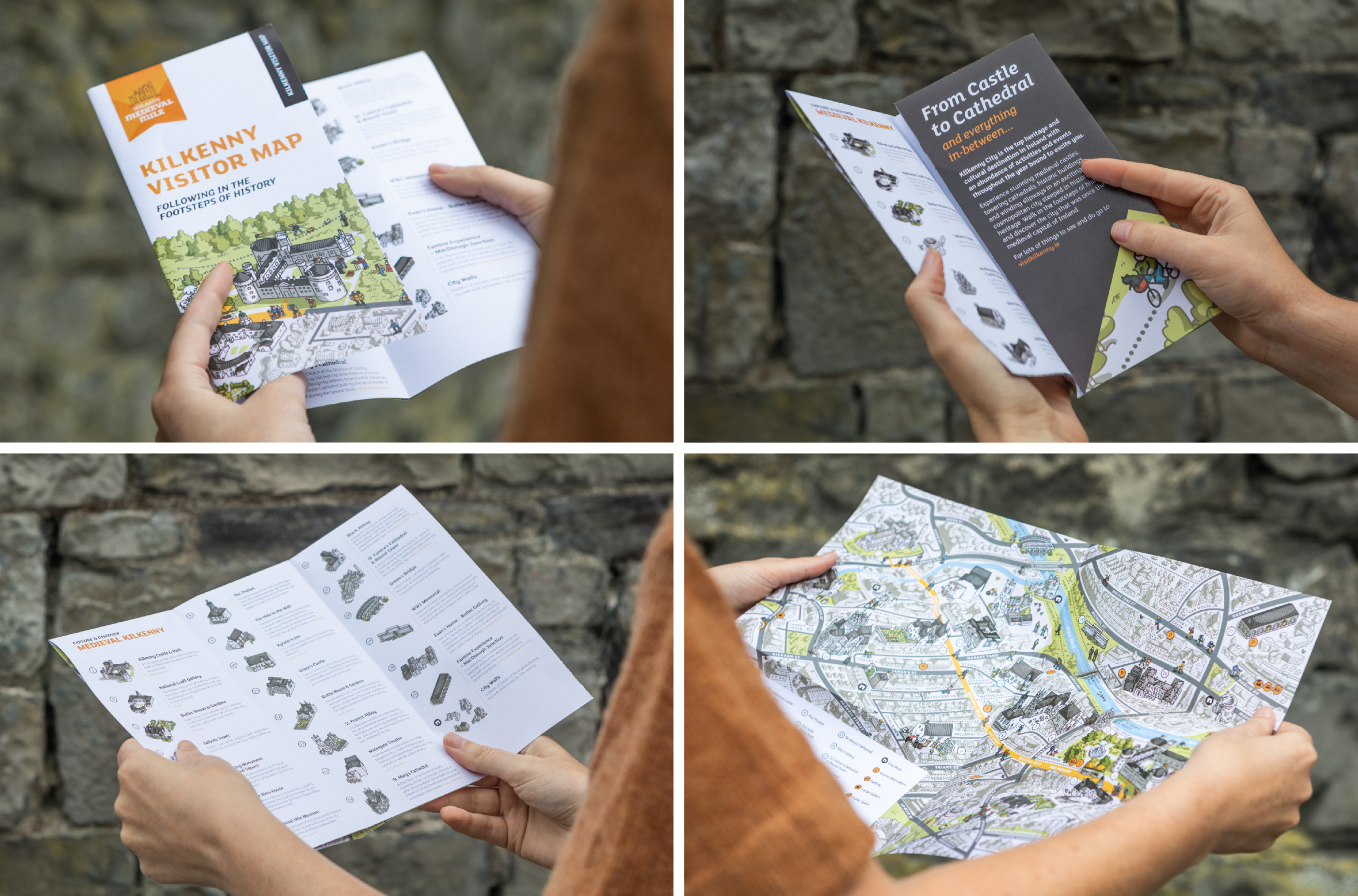
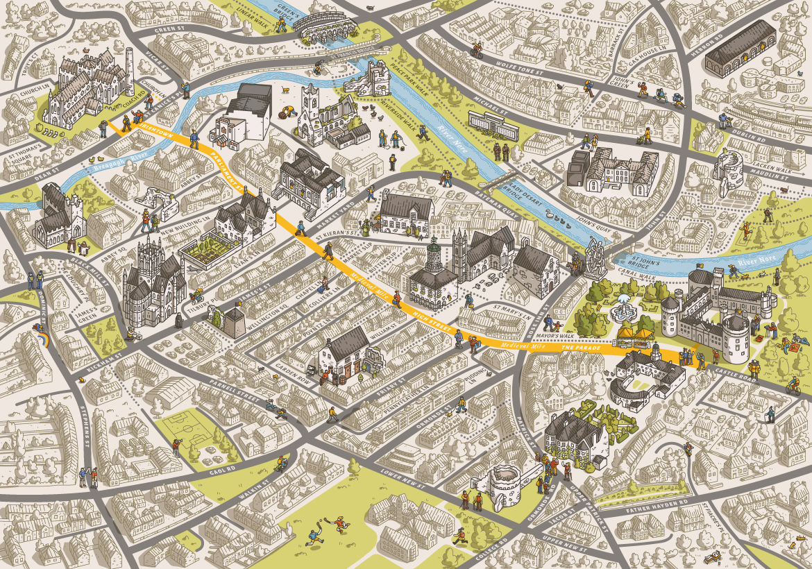
Kilkenny City Visitor Map
2021
Designed by Peter-Tim Lynch, Ross Curran and Rocky Grennell at designworks
Illustrator: Gergő Gilicze
Categories: Promotional / Printed Publication
Industry: Cultural
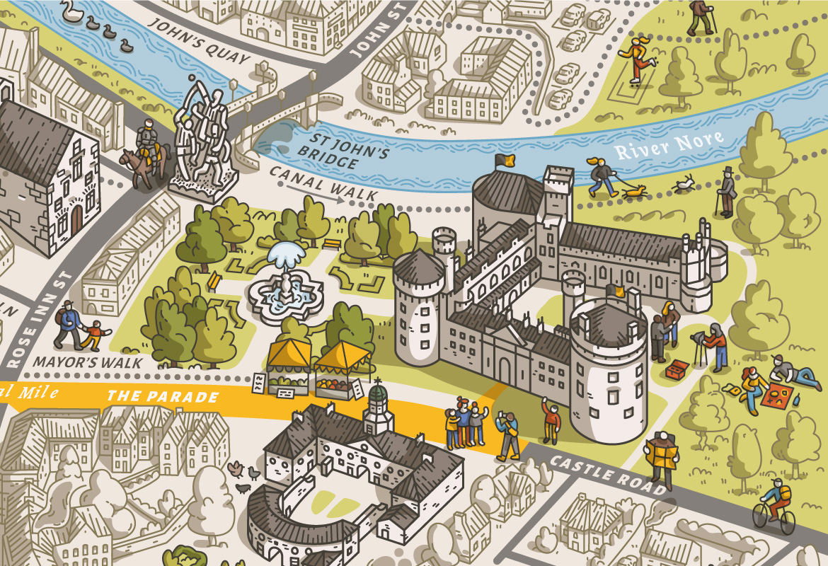
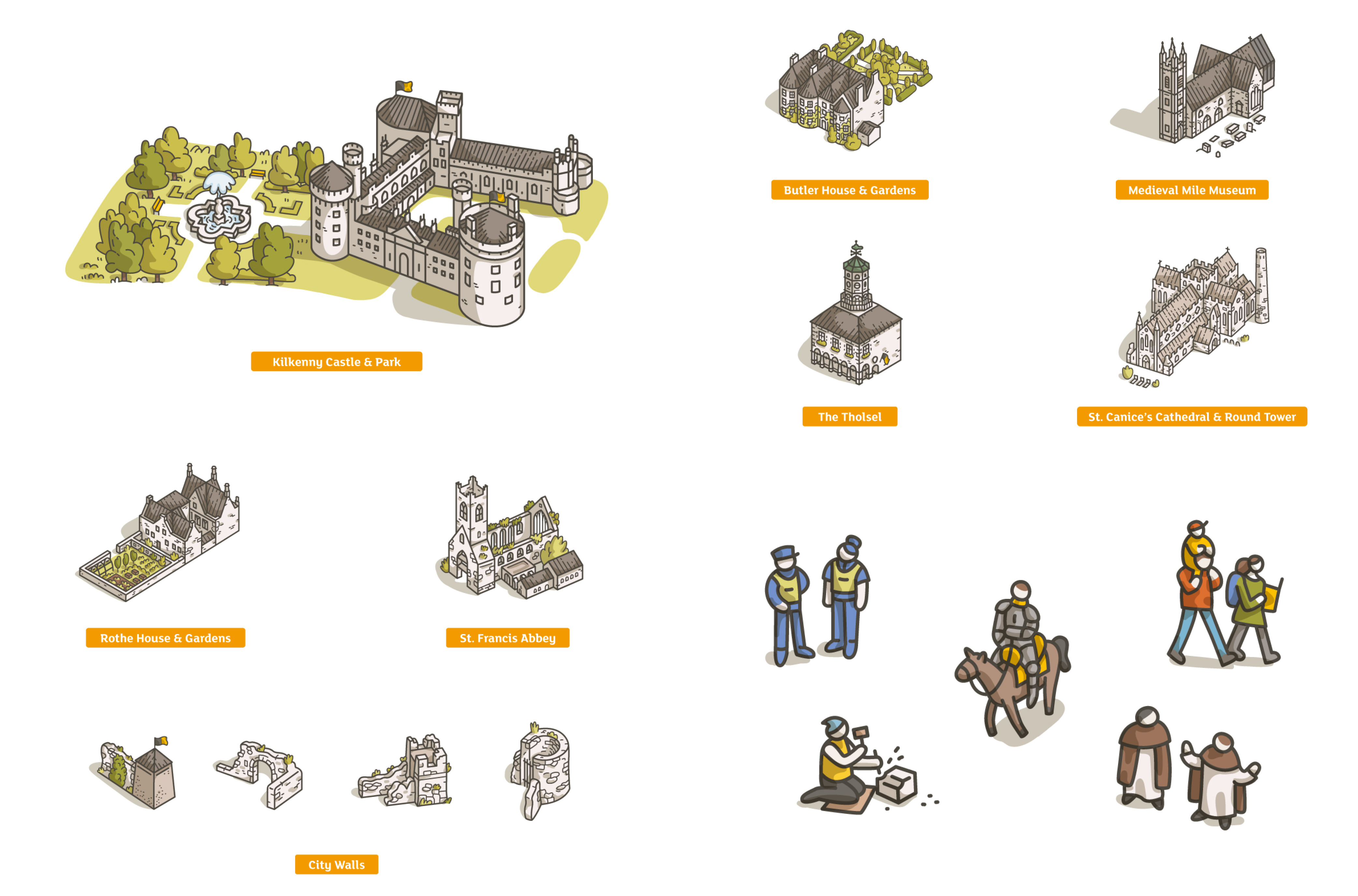
As part of their Visitor Orientation Strategy, Kilkenny County Council set out an action plan to develop an improved visitor experience in Kilkenny City. To support the Orientation Strategy, DesignWorks were commissioned to produce a new visitor map to highlight 'Ireland’s Medieval Mile', a short walking trail connecting the famous Kilkenny Castle to St. Canice’s Cathedral, with an abundance of attractions and activities along the way.
Central to the plan is enabling the easy flow and movement of visitors throughout the city – capitalising on the large numbers visiting the Castle – and orientating them out towards the Medieval Mile, River Walk and Abbey Quarter areas of the city.
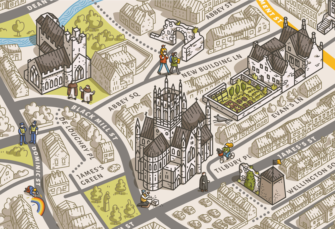
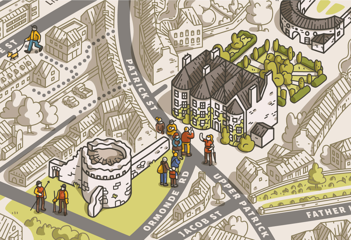
To produce the map we teamed up with renowned city mapping illustrator Gergő Gilicze from Hungary. Gergő creates distinctive cityscapes infused with character and humour, with particular expertise in capturing Medieval heritage.
The map is available for all visitors to Kilkenny, highlighting landmarks and indicating pedestrian routes and walking times throughout the City. It features on new signage, digital applications and has been produced as a pocket-map.
The unique medieval vibe of Kilkenny City has been brought to life with discerning and quirky detail… Visitors are invited to find the nine cats hidden in the scene, or Ireland’s last wolf.